13 Must-See National Parks In the American West (a.k.a. 13 Reasons to Pack the RV and Hit the Road)
One-of-a-kind wonders.
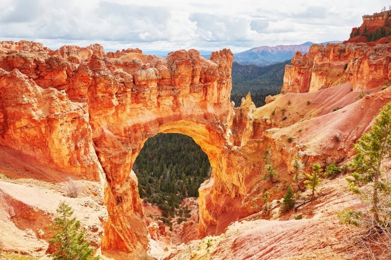
Be it the wistful painted deserts, the fanciful red-rock formations, or the world-famous canyons, the American West has always had a particular pull, drawing explorers, prospectors, and now, tourists. Visitors seek out both the natural beauty, as well as the western aesthetic painted by films and television. Regardless of what it is you might be looking for, the national parks of the west are sure to serve as the perfect backdrop.
Petrified Forest National Park (Arizona)
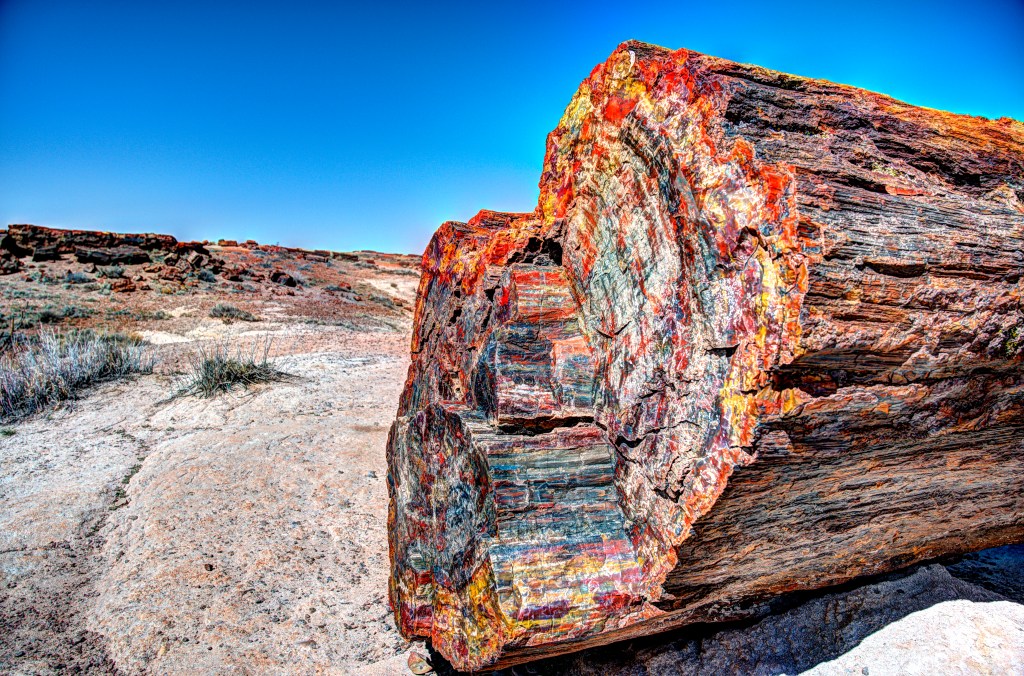
Though Northeastern Arizona’s Petrified Forest was established as a national park as recently as 1962, this 200,000 acre landscape preserves millions of years of history. Here, archeologists have unearthed Triassic-period fossils, as well as the world’s largest collection of prehistoric petrified wood.
One of the original national monuments declared by Theodore Roosevelt in 1906, the park is comprised of two main areas. To the south, the park’s namesake petrified wood dates back 225 million years. It’s made up of almost solid quartz. To the north, the Painted Desert is a fitting title for the orange and pink-hued badlands made of clay and mudstone. In between sprawl more than 50,000 acres of designated wilderness. A 28-mile road winds through the varied scenes, with lookout points to take it all in.
Several hiking trails offer the chance to see the famed petrified wood. The Giant Logs route (less than a half-mile) leads to Old Faithful, a fossilized log with a diameter of almost 10 feet. Another trail leads to Agate House, an eight-room pueblo home built from petrified wood between 1050 and 1300. Both trails can be accessed from the Rainbow Forest Museum.
In the Painted Desert, Kachina Point is the site of the Painted Desert Inn. Don’t be fooled by the name, though: The adobe-style historic landmark now functions as a museum. If its walls could talk, they would tell of its 100-year history and its heyday in the 1940s as a respite for travelers along the historic Route 66 highway. But it would be merely a drop in the bucket compared to the millions of years preserved in the surrounding petrified forests.
Visiting Petrified Forest National Park
On the park’s north side, the Painted Desert Visitor Center is at exit 311 off I-40. The complex features a gas station and a diner serving breakfast, lunch, and grab-and-go options. The park is open year-round, but go in fall or spring for the mildest weather. Camping is the only way to overnight. Find lodging in the nearby town of Holbrook.
Arches National Park (Utah)
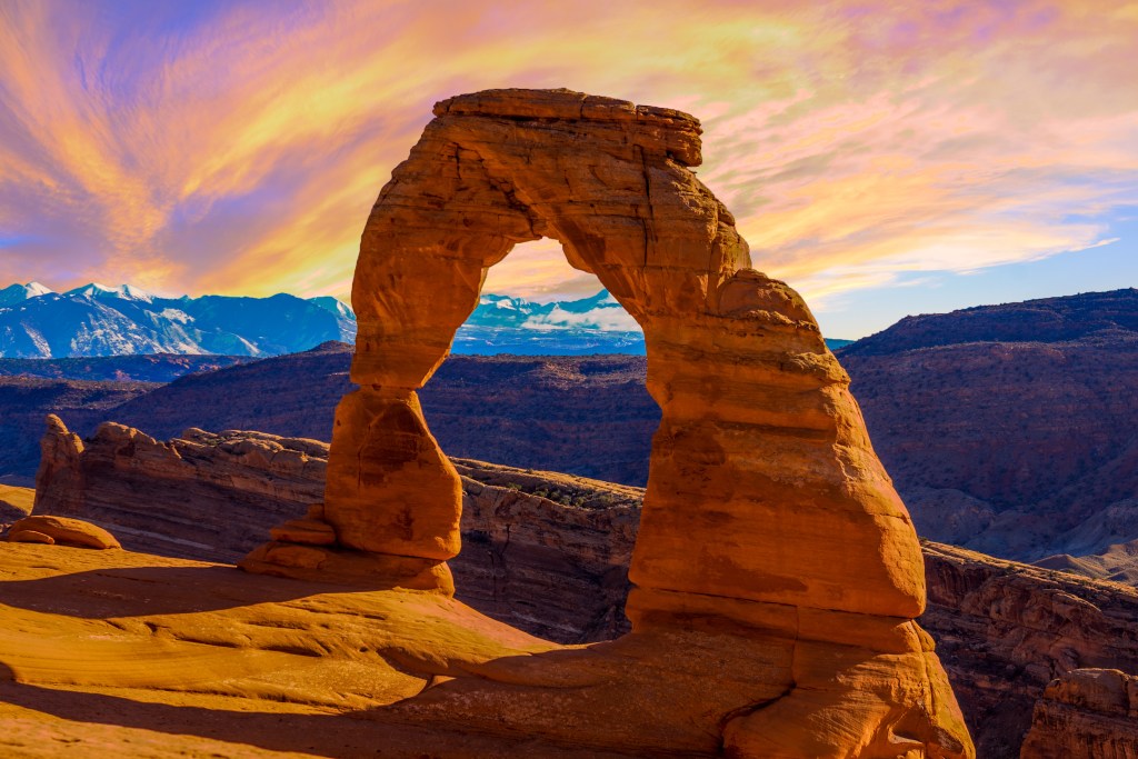
Like a seussian skyline jutting out of the high desert country of the Colorado Plateau, Arches National Park contains the greatest density of its namesake arches in the world. Visitors discover more than 2,000 of these natural formations, not to mention countless red spires, pinnacles, stone fins, and giant balanced rocks, each uniquely shaped inside 120 square miles along the banks of the Colorado River.
Fine-grained entrada sandstone layered into perfectly parallel lines, combined with the area’s slightly above-average rainfall and cold desert nights, allows these strange formations to exist. Every natural arch illustrates 300 million years of patient erosion. Ironically, however, the erosion that created these arches will eventually destroy them.
No one knows how much longer America will have these feats of nature. The need to protect this vulnerable landscape was sparked in the 1950s, after nature writer and Arches park ranger Edward Abbey wrote passionately about it in Desert Solitaire: “Wilderness is not a luxury but a necessity of the human spirit, and as vital to our lives as water and good bread.”
Established as a national park in 1971, Arches entertains with surreal skylines at every turn. Its 18-mile scenic drive lends panoramas such as Balanced Rock, right off the side of the road. Landscape Arch Hike leads to the longest arch in North America — a fragile ribbon of stone longer than a football field — while also passing Navajo Arch, Partition Arch, Pine Tree Arch, and Tunnel Arch. Meanwhile, the iconic Delicate Arch (immortalized on Utah’s license plate) might be the most famous image in a state bursting with legendary landmarks. A 3-mile strenuous hike (the park’s most popular) takes trekkers to the foot of this sandstone bow. From the Courthouse Towers to the Windows Section, not one inch of Arches disappoints.
Visiting Arches National Park
Meander through the labyrinth of narrow sandstone canyons at Fiery Furnace. This can only be explored on a ranger-led adventure. Book one at Arches Visitor Center, open year-round. Ideally, visit during spring or fall to avoid the blistering summer days and freezing winter nights. There are no lodges inside Arches. Reserve a spot at the 50-site Devils Garden Campground to experience the park by moonlight. Book up to six months in advance. The town of Moab offers a full range of accommodations, restaurants, and excursions (including to nearby Canyonlands National Park).
Carlsbad Caverns National Park (New Mexico)
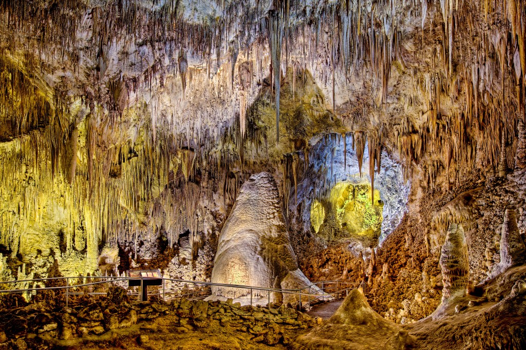
Beneath the surface of the Chihuahuan Desert lies a hidden world — enormous stalactites and stalagmites, 18-foot gypsum “chandeliers,” and the largest cave chamber in North America. Established as a national monument in 1923 then designated a national park in 1930, Carlsbad Caverns is a limestone labyrinth so outstanding that UNESCO inscribed it as a World Heritage site.
The 175-plus miles of caves still intrigue researchers, while visitors can explore 3 miles of subterranean passageways. Some 120 caves have been recorded in Carlsbad Caverns. Formed as acidic groundwater slowly wore down limestone that was once part of an ancient undersea reef, Carlsbad Caverns is most famous for its aptly named Big Room. Self-guided tours (tickets required) lead travelers 750 feet down the steep Natural Entrance Trail into the 8.2-acre chamber with its many bizarre geologic features. Ranger-guided group tours delve into the park’s more adventurous restricted areas, such as King’s Palace, Spider Cave, and Hall of the White Giant.
Rivaling Carlsbad Caverns’ grandeur is its seasonal exodus of Mexican free-tailed bats each night. The flight led to the discovery of the cave in the 1880s. It remains one of its most amazing phenomena — which is saying a lot for a place that’s been called “the Grand Canyon with a roof over it.”
Visiting Carlsbad Caverns National Park
Park rangers host a free Bat Flight Program on summer evenings at the outdoor amphitheater, near the mouth of the cave. The best flights take place in August and September. At the visitor center, Carlsbad Caverns Trading Company serves sandwiches, salads, and snacks. As there is no overnight lodging or campground in the park, stay in Carlsbad, 20 miles away. Combine a visit to the caverns with a trip to Guadalupe Mountains National Park, 40 minutes away in Texas.
White Sands National Park (New Mexico)
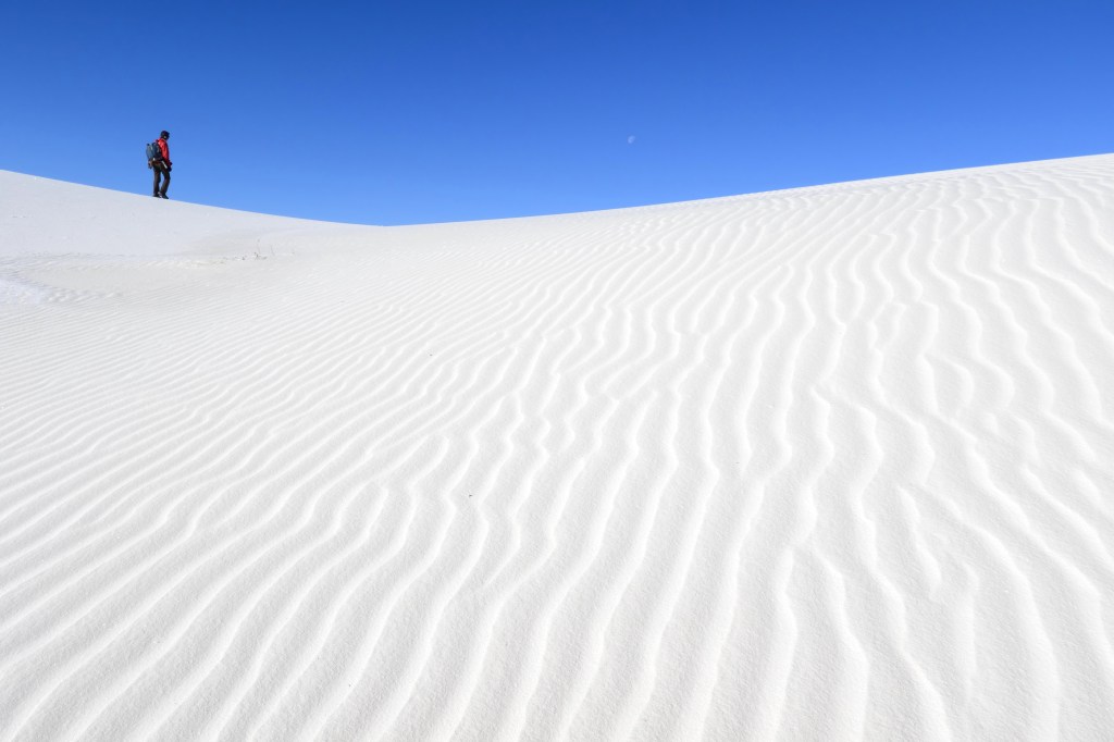
A description of White Sands National Park reads like a personal ad: enjoys picnics, sunset strolls, moongazing, and long walks in the sand. In fact, this rare gypsum dune field — the largest in the world — is so pretty that simply wandering around staring at it is the top activity.
Established as a national monument in 1933 and a national park in 2019, White Sands receives the most visitors of any NPS site in New Mexico. Day-trippers come to cruise down Dunes Drive (16 miles round-trip), which heads into the heart of the site from the visitor center, passing pull-offs, covered picnic spots, and five trailheads. By day, visitors set up beach umbrellas and sled down the dunes. By night, they watch as light from the full moon reflects off the snow-white sand.
Located in the Tularosa Basin of the Chihuahuan Desert, the dune field formed as melting snow from the slopes of the surrounding mountains deposited gypsum into seasonal Lake Lucero. As the lake fills then evaporates each year, the dunes grow, and they now range from 10 to 60 feet. White Sands’ dune field is very active, with some dunes shifting up to 30 feet a year. The dune field extends for 275 square miles, though only 115 square miles are protected within the monument. The remainder is located on private military land.
Visiting White Sands National Park
Start at the Adobe Visitor Center, constructed in the 1930s in Spanish Pueblo style. Here, you can buy cheap plastic sleds for a day of sliding on the dunes. Hiking trails include the Interdune Boardwalk (0.4-mile round-trip), Dune Life Nature Trail (1-mile loop) and the demanding Alkali Flat Trail (5 miles, no shade). Accommodations and amenities are available in the nearby towns of Alamogordo and Las Cruces. Note: Because White Sands adjoins White Sands Missile Range, the park occasionally closes during missile testing.
Zion National Park (Utah)
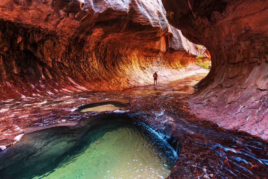
The first and most popular of Utah’s Mighty 5 national parks, Zion is also its most diverse. Lush, green junipers and hanging emerald gardens contrast with ruddy to milky cliffs, carved over millennia by the Virgin River. An oasis in Utah’s southeastern desert, Zion’s canyon walls surround visitors as the glacial river flows across the valley floor. The exposed rock layers reveal Earth’s varied epochs, from swirling sandstone and ancient mudstone stamped with dinosaur tracks, to petrified wood and marine fossils.
Instead of looking down on Zion’s spectacular canyon from above, like in most famous parks, sightseers experience its Navajo sandstone giants up close, from the ground up. Nothing embodies this experience better than hiking The Narrows, which bends along — and often in — the slick-pebbled Virgin River bed.
Historically, apart from Native Americans, only determined Mormons traversed this remote and rugged landscape with wagon trails for roads. It was these pioneers who named the area Zion, “promised land.” Established as a national park in 1919, Zion employed Civilian Conservation Corps team to carve out solid-rock tunnels and knife-edge roads such as the awe-inspiring Zion–Mount Carmel Highway.
Doable hikes such as Weeping Rock, Lower Emerald Pools, and Upper Emerald Pool also offer great rewards. However, Angel’s Landing is the ultimate destination for bragging rights. Blazed by the CCC, this four-hour trek of switchbacks, thousand-foot drop-offs, and a single chain handrail leads along a steep, narrow ridge to a 360-degree view of the park. It’s one of the most hair-raising hiking trails in the entire nation — yet still only one of Zion’s myriad marvels.
Visiting Zion National Park
The south entrance is the hub of Zion. To sleep inside the park, reserve early for Zion Lodge and Watchman Campground. Or, try the first-come, first-served sites at the South Campground. Find numerous lodging and dining options in the gateway village of Springdale. If The Narrows is a must-do, avoid the early spring snowmelt, as the trail is only open during low-water levels. Zion Outfitters in Springdale rents all the hiking gear for The Narrows (waterproof boots and walking sticks are a necessity) as well as inflatable tubes for a Virgin River float. A free mandatory shuttle service maintains the serenity of the canyon during peak season (February to November). Shuttles depart every seven to 10 minutes from the Zion Canyon Visitor Center.
Great Sand Dunes National Park and Preserve (Colorado)
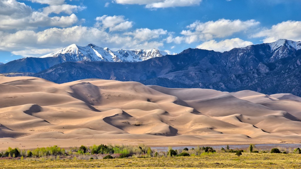
Eric Brinley/Shutterstock
In a distinctive corner of south-central Colorado, you don’t need snow to sled. And you don’t need an ocean to go to the beach. You do, however, need closed-toe shoes in the scalding sand. This geographic curiosity is Great Sand Dunes National Park, formed in 2004 and home to the tallest sand dunes in North America. Covering more than 30 square miles between the San Juan Mountains and the Sangre de Cristos range, the dune field resulted when mountain streams deposited sand into prehistoric shallow lakes in the San Luis Valley and the lakes eventually dried up. Wind took over from there, sculpting the sand into towering mounds, some more than 700 feet high.
The highest, Star Dune, reaches 750 feet, and a round-trip hike to the summit requires five hours. Alternately, 692-foot High Dune, entailing a two-hour round-trip, is the most popular to explore. But with no designated trails in the sand, visitors are free to play wherever they wish.
Baking in the summer, the sand’s surface can reach 150 degrees, but the dunes cool
in the evenings and mornings. Visitors can seek refreshment at seasonal Medano Creek, which cuts an unlikely stream through the desertscape after the spring snowmelt. Nicknamed Colorado’s secret beach, the area fills with families in late May and early June. Outfitters provide gear for sand sledding and sandboarding on the dunes. From hot sand to cool creek, the park forges a lively playground for adults and kids alike.
Visiting Great Sand Dunes National Park and Preserve
The park, including the Visitor Center and Piñon Flats Campground, is at the north end of CO
150. Rent sandboards and sand sleds year-round from Kristi Mountain Sports in Alamosa. Hiking and horseback riding are popular pastimes; favorite trails include the Montville Nature Trail and Mosca Pass. Stay at the Zapata Ranch to book a horseback ride through Zapata Partners, the only park-authorized horseback-riding outfitter.
Bryce Canyon National Park (Utah)
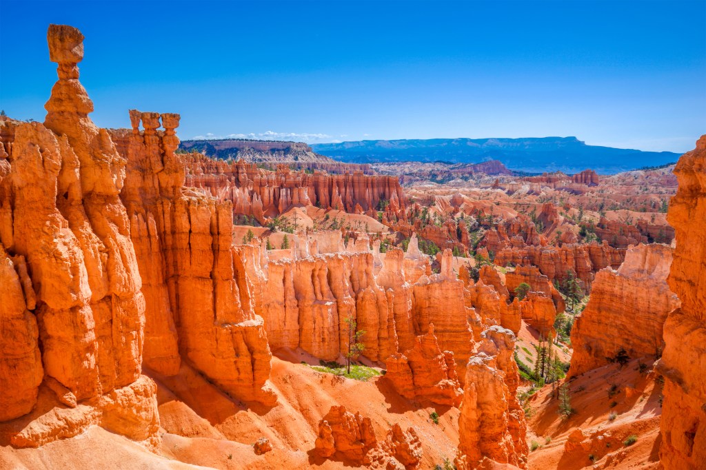
Opening out of a nondescript pinewood forest like a portal to an alien planet, Bryce Canyon has to be seen to be believed. In this 55-square-mile valley stand thousands of sun-baked turrets and bulbous columns, some reaching over 10 stories tall. This remote city of rock towers, called hoodoos, was carved by freezes and thaws over thousands of years. Bryce Canyon contains the densest collection of hoodoos in the world.
Pursuing wayward livestock, a farmer named Ebenezer Bryce first wandered into the area in 1875, exclaiming this was “one hell of a place to lose a cow.” Locals began calling his discovery “Bryce’s Canyon,” and rumors of its eccentricities made their way to Washington. Congress established it as Utah’s second national park in 1928.
The park’s 37-mile scenic drive skirts the rim, passing meadows dotted with prairie-dog colonies and accessing pull-offs like Yovimpa and Rainbow points, which reveal views of the entire spectacle from 9,000 feet. Four main overlooks command a vista of Bryce Amphitheater, the park’s most popular area.
Early birds can explore the enchanted network of trails below the rim, diving deep among the glowing hoodoos on the canyon floor. The serpentine Navajo Trail to Queens Garden Hike gets explorers down into the heart of Bryce. Nearby, on the Queen’s Garden Trail, trekkers can spot Thor’s Hammer balancing to the northeast.
Whatever the path, each turn in Bryce Canyon brings visitors to yet another rusty giant with secret passageways burrowing into the walls. Though not a secret, the park welcomes more than 2 million people a year. The otherworldliness of Bryce’s beauty is still a discovery to those who step into its realm.
Visiting Bryce Canyon National Park
Shuttles run into the park from the Bryce Canyon Visitor Center from April to September, and
most overlooks remain open through winter. Bryce Canyon Lodge, as well as Sunset and North campgrounds, provides accommodations inside the park during peak season, while Bryce Canyon City offers even more choices. At a high elevation, Bryce offers a reprieve from Utah’s summer heat as the coolest of Utah’s Mighty 5 parks. Late spring through early fall is ideal for hiking.
Mesa Verde National Park (Colorado)
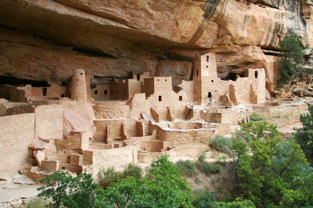
From A.D. 600 to 1300, Ancestral Puebloans made their homes in what is now southwest Colorado. Using stones, these ancient peoples cut sandstone blocks and bonded them with mortar, building dwellings into the walls of the Navajo Canyon. At its peak, this community may have numbered as many as 5,000. For 700 years, daily life carried on. And then, mysteriously, the natives vacated their dwellings, never to return. Hundreds of years passed before two ranchers happened upon one of the abandoned sites.
President Theodore Roosevelt established Mesa Verde as a national park in 1906, and the park was declared a UNESCO World Heritage site in 1978. Today, Mesa Verde protects almost 5,000 known archeological sites, including 600 cliff dwellings — some of the best-preserved archeological zones on the continent.
The Cliff Palace, its biggest and most famous, comprises more than 150 individual rooms and 23 kivas (ceremonial spaces). Other significant dwellings include Balcony House — accessible via a 32-foot ladder — Long House, Step House, and Spruce Tree House, which is closed indefinitely because of falling rock.
The park attracts almost 600,000 annual visitors, who can stand in awe before ancient terraces, field houses, shrines, reservoirs, ditches, and rock art — a magnificent tableau of pre-Columbian life, now fixed forever in time.
Visiting Mesa Verde National Park
Tickets are required to tour Cliff Palace, Balcony House, and Long House; visit the Mesa Verde Visitor and Research Center early to buy them (in-person only). Spruce Tree House is closed, but you can observe it from overlooks close to the Chapin Mesa Archeological Museum. There is one campground (Morefield) and one lodge (Far View) inside the park.
Saguaro National Park (Arizona)
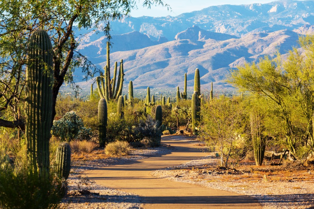
Around 1,500 plant species flourish in Saguaro National Park, but only one is king. The saguaro tree, nicknamed the “desert monarch,” is the largest cactus in the United States, growing to 40 feet tall, living up to 200 years, and weighing more than a ton at full height. Though the saguaro (pronounced sah-wah-ro) has become a symbol of the American West, it only grows in the Sonoran Desert of southern Arizona. Some 1.6 million saguaro trees pierce the skyline of Saguaro National Park, established in 1994. The saguaro cactus is a source of food and shelter for many desert animals.
In April, the cacti bloom with pretty white blossoms — Arizona’s state flower. Wildflowers also put on a spring show: Photographers are in heaven amid a rainbow of brittle bushes, desert marigolds, globe mallows, lupines, and Mexican poppies. The best place to encounter Saguaro’s signature cactus is the Tucson Mountain District, aka Saguaro West. Relatively hot and arid, this low desert is home to coyotes, desert tortoises, javelinas, and quail, as well as 4,687-foot Wasson Peak.
To the east lies the Rincon Mountain District (Saguaro East), where the saguaro forest gives way to higher-elevation pine forests that support wildlife like black bears, deer, and Mexican spotted owls. Between the two districts sits the city of Tucson. Scenic drives, panoramic overlooks, and 165 miles of hiking trails provide vantage points for observing the stately saguaros as they rule over the vibrant Sonoran — boasting the most variety of life of any desert on the continent.
Visiting Saguaro National Park
Each side of the park has its own visitor center: Red Hills Visitor Center in Saguaro West and the more rustic Visitor Center in Saguaro East. In the latter, take the 8-mile Cactus Forest Scenic Loop Drive and stretch your legs on the Desert Ecology Trail. In Saguaro West, the Bajada Scenic Drive is a 6-mile loop with trailheads to day hikes like the paved Desert Discovery Nature Trail. To reach Wasson Peak, hike the Kings Canyon Trail (7 miles round-trip).
Rocky Mountain National Park (Colorado)
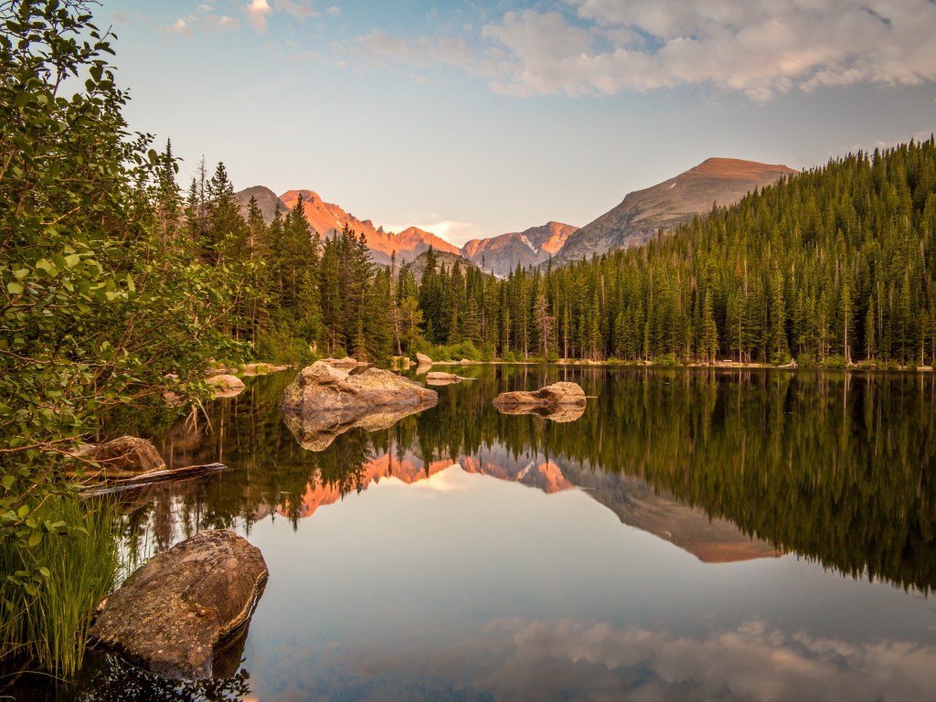
In the United States’ 10th national park, a two-lane highway leads into the sky. Completed in 1932 and climbing to 12,183 feet, Trail Ridge Road is America’s highest continuous paved highway. The road provides exceptional access to some of the nation’s finest alpine country, connecting the park’s eastern and western entrances and winding for 48 miles across forests, meadows, treeless tundra and the Continental Divide.
Elsewhere in the park, Bear Lake’s flat, 0.6-mile nature trail is one of Rocky Mountain’s most popular hikes. And Pike’s Peak, though only the 31st-tallest summit in the Rockies, is the most-traversed mountain in all of North America. For the park’s 4.5 million annual visitors, these superlatives are only surpassed by Rocky Mountain’s diverse animal populations. Wildlife viewing is the park’s top attraction, thanks to the impressive playbill of “charismatic megafauna” such as elk, mule deer, moose, and bighorn sheep. In total, 67 species of mammals call the park home, including marmots and pikas.
In 2015, the park turned 100 years old, and it owes its existence in part to naturalist, guide, and local lodge owner Enos Mills, who advocated for its creation. His endeavor met with success when President Woodrow Wilson signed the park into law in 1915. Today, as one of the most actively explored national parks in the country, RMNP has solidified its standing as a prized national treasure.
Visiting Rocky Mountain National Park
A 1.5-hour drive from Denver, the tourist town of Estes Park is the main gateway to the park. Get oriented at the Frank Lloyd Wright–influenced Beaver Meadows Visitor Center. Trail Ridge Road is open from late May to mid-October; worthwhile stops include the 4-mile Ute Trail
and the Alpine Visitors Center, the highest-elevation visitor center in the entire national park system. Visit in September or “Elk-tober” to see bugling elks during mating season.
Grand Canyon National Park (Arizona)
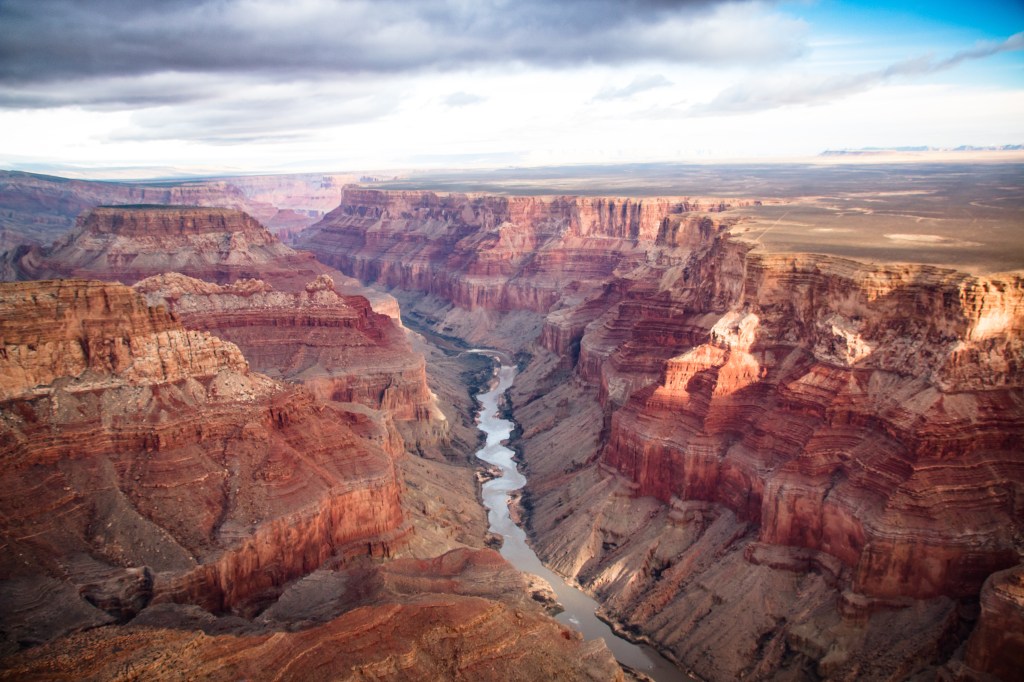
As grand as the statistics are — 1.2 million acres, 277 miles long, 4,000 feet deep — nothing prepares the 5 million-plus annual visitors for the magnitude of Grand Canyon National Park. Our sixth-most–visited national park celebrated its 104th birthday this year, and still has many stories to tell. The Grand Canyon exhibits three of the four eras of geologic time.
The South Rim is the most popular destination and the gateway to iconic overlooks such as Yavapai and Mather points. More intrepid souls venture to the remote North Rim (closed in winter), where higher elevations mean unparalleled views like the ones from Point Imperial and the West Rim, where the glass-bottom Skywalk hovers 4,000 feet above the canyon floor. Exploration here is hands-on and up-close. Riding a mule down into the canyon, biking along the rim, hiking trails like Kaibab or Grandview, and rafting the Colorado River reveal the living history of this place. No matter the angle of the view, the word “grand” doesn’t seem quite grand enough.
Visiting Grand Canyon National Park
Most visitors coming from Flagstaff take Highway 180 North into the park, but entering through the lesser-used east entrance on Highway 89 North is a fun alternative. Stop at viewpoints overlooking the Little Colorado River Gorge and again at the Desert View Watchtower, built by famed architect Mary Colter in 1932. Summer and spring break see the most visitors, so if you plan to stay overnight in the park during these times, book at least a year in advance. Campers need a permit.
Antelope Canyon (Arizona)
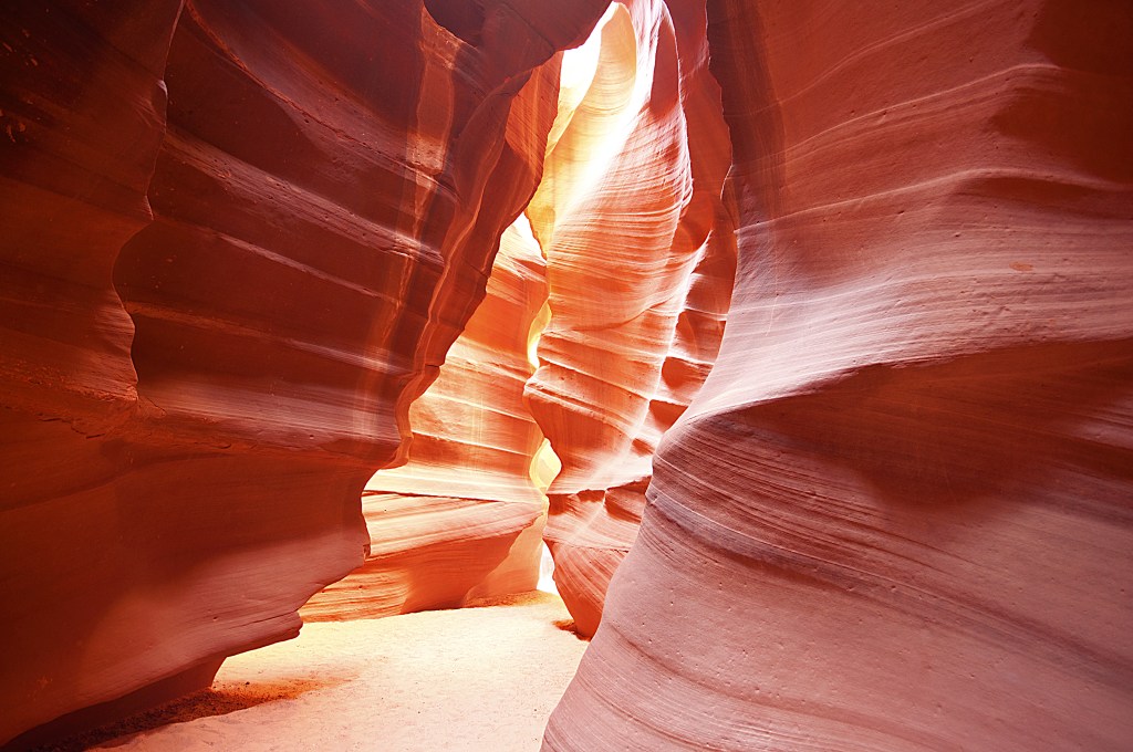
To the Navajo’s of long ago, going into Antelope Canyon was like walking into a temple. They might quiet their minds, humble their spirits, and seek a divine connection to Mother Nature: The experience of entering a place of such natural beauty was transcendent, spiritual. Today, the site lies within the LeChee Chapter of the Navajo Nation . It is managed by Navajo Parks & Recreation and visitors can still marvel at the canyon’s striking splendor.
Not one slot canyon but two — Upper (“The Crack”) and Lower (“The Corkscrew”) — this picturesque icon has become the most visited and photographed slot canyon in the American Southwest. Formed as flash flooding eroded Navajo sandstone into smooth curves and extraordinary shapes, Antelope Canyon gives sightseers the sense of having stepped inside a dynamic art installation. Antelope Canyon got its name from the herds of pronghorn antelope that once roamed its floor.
Photographers flock here, but anyone can appreciate this vermillion landmark and its 120-foot contoured walls. Upper Antelope is more accessible, spanning 660 feet of flat sand. A 15-minute drive away, Lower Antelope extends for 1,335 feet and requires navigating several sets of steel stairs. For safety, booking an authorized tour is required. Up to 2,000 visitors a day pass through Antelope Canyon’s crimson corridor. Still, despite the heavy foot traffic, both sections facilitate ethereal photos and leave observers spellbound. In this busy but sublime setting, it seems there’s still opportunity for reflection and awe.
Visiting Antelope Canyon
General tours of Upper Antelope Canyon last 90 minutes; Lower Antelope tours take one hour. Special photography tours are available at Upper Antelope year-round (book well in advance) and at Lower Antelope in the winter months. The canyon’s famous light beams are best captured between late March and early October. For a complete list of authorized guides, visit navajonationparks.org. Stay in the nearby city of Page, or camp at Wahweap Marina on Lake Powell. The Grand Canyon and Grand Staircase Escalante National Monument are both within easy driving distance.
Guadalupe Mountains National Park (Texas)
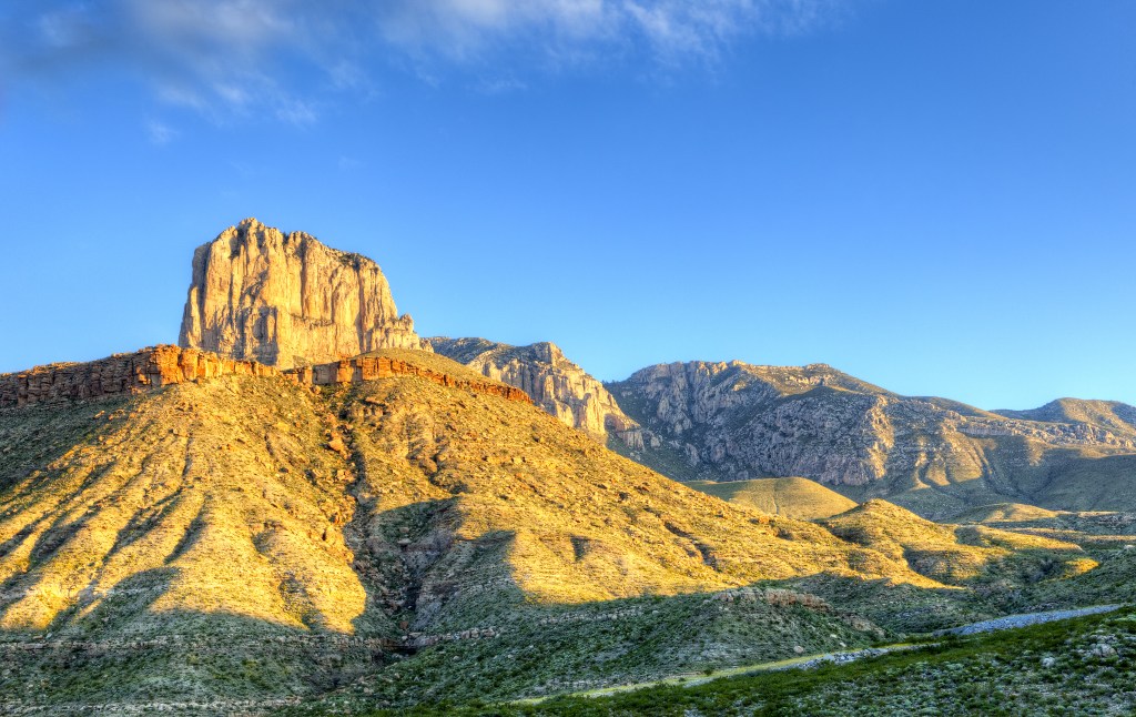
Unlike many national parks whose peak visitor season occurs during the summer, Guadalupe Mountains National Park shines in the autumn, when its scenic McKittrick Canyon comes alive with fall colors. Together with limestone canyon walls and lazy McKittrick Creek, the scene is considered the most beautiful spot in all of Texas. Beyond McKittrick Canyon, other wonders await — the four highest peaks in the state, as well as the well-preserved Capitan Reef, the largest Permian fossil reef in the world. Part of the Guadalupe Mountains, this 260-million-year-old ridge was once covered by sea. Highpointers (those aiming to climb the highest summits in each of the 50 US states) make a beeline for 8,749-foot Guadalupe Peak, the “rooftop of Texas.”
Regardless of the destination, visitors keep watch for the park’s varied wildlife, from birds of prey such as golden eagles and peregrine falcons, to nocturnal desert dwellers like coyotes, kit foxes, bobcats, mountain lions, and badgers. Black bears, elk, gray foxes, skunks, mule deer, and porcupines inhabit the park’s higher elevations.
After dark, stargazers can easily observe more than 11,000 stars, as well as the Milky Way. The sight is a well-earned reward for those intrepid enough to camp out in this Wild West wilderness — and concrete proof that the stars at night are indeed big and bright, deep in the heart of Texas.
Visiting Guadalupe Mountains National Park
The park features 80 miles of hiking trails. Its signature trail up to Guadalupe Peak, climbs 3,000 feet in 8.5 miles. Get a photo op by the monument at the peak and sign the logbook. The full McKittrick Canyon Trail rambles 5 to 7 miles round-trip, but less experienced hikers can get a taste on the easier 0.9-mile McKittrick Canyon Nature Trail. The best views of the Capitan Reef are found on the 4.2-mile Devil’s Hall Trail. The park operates two information centers, as well as two campgrounds, one at Pine Springs, the other at Dog Canyon.
A version of this article appeared in our partner magazine Complete Guide to the National Parks.


