Make Your Way to the Midwest: These 8 National Parks Are Sure To Leave You Speechless
America’s Heartland flaunts its own kind of beauty.
Though perhaps not as epic as the great parks out West, America’s Heartland flaunts its own kind of beauty, from barren badlands and idyllic islands, to mystic caves and verdant valleys. While many of these spots fly under the radar, they’re worth the trip for their diverse landscapes and unique opportunities to explore. Get out there and see what these midwest national parks have to offer.
Badlands National Park (South Dakota)
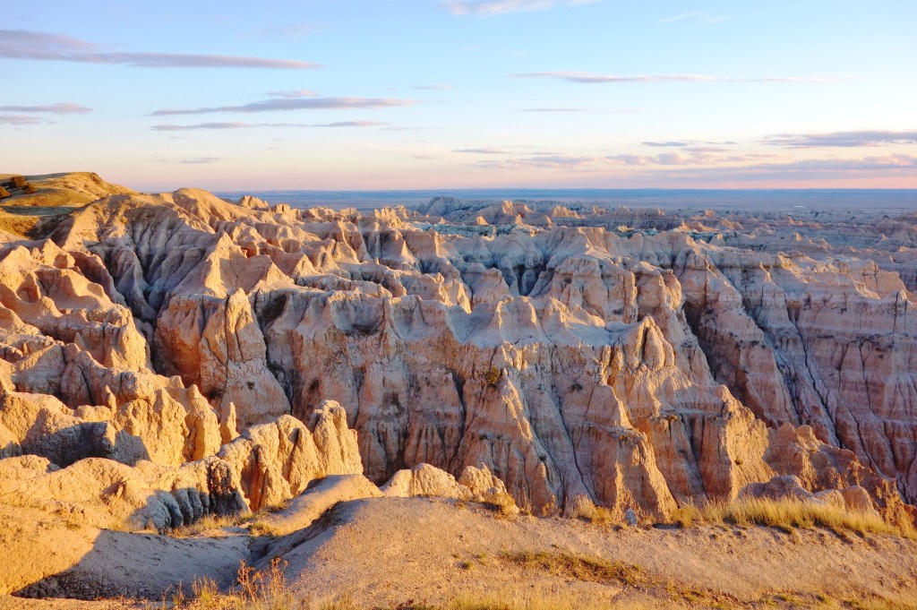
When the Lakota people first encountered southwestern South Dakota’s harsh terrain, they called it mako sica — “land bad.” Today, however, the intensely eroded pinnacles, buttes, fins, and spires of Badlands National Park are some of its greatest assets. Created in 1978, the park welcomes over 1 million annual visitors who come to behold its pyramid-like rock formations. The backbone of the park’s topography is the Wall; this 60-mile escarpment tells a story of erosion millions of years in the making. Shale, sand, gravel, iron oxides, and volcanic ash tinted the badlands’ colorful sediment, and the remarkably striped badlands were once an ancient seabed. Day-trippers can savor views of the Wall and other vistas along the 39-mile Badlands Loop State Scenic Byway. On the other hand, short hikes on the Door and Window trails get adventurers up close.
Other marvels in this park range from the largest mixed-grass prairie in the US to prolific wildlife. Bison, pronghorn, deer, prairie dogs, coyotes, snakes, eagles, and hawks are often seen from Sage Creek Rim Road. Perhaps even more impressive is the park’s paleontology: Badlands National Park holds the planet’s richest fossil beds from the Oligocene epoch. Aspiring archeologists can get their bearings on the Fossil Exhibit Trail, then freely explore the park searching for prehistoric relics (all fossils must remain in the place they were found). Surely, after happening across the ancient jaws of a three-toed horse or saber-toothed cat, there will never be any question that these badlands are indeed full of goodness.
A Guide to the Badlands
Popular hikes in the park include the Notch Trail (1.5 miles round-trip) and the Castle Trail (10 miles). Get info at the Ben Reifel Visitor Center, close to the Cedar Pass Campground (primitive camping is available at the Sage Creek Campground). The historic Cedar Pass Lodge provides the only hotel lodging within park borders. You can also find alternative accommodations in Rapid City, an hour’s drive away. If you have more time, head over to the park’s Stronghold and Palmer Creek units, part of the Pine Ridge Indian Reservation of the Oglala Sioux.
Indiana Dunes (Indiana)
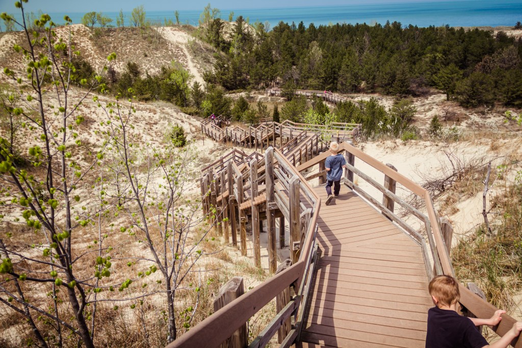
A new addition to the National Park system is Indiana Dunes, which officially earned its status on February 15, 2019, after a century-long attempt. Formerly known as Indiana Dunes National Lakeshore, the 15,000-acre park sits along 15 miles of Lake Michigan’s southern shore with forest, dunes, marshes, and prairies, along with 50 miles of hiking paths. Since joining the National Park ranks, tourism has risen in the area to the highest levels in eight years. Conservationists worked to save the dunes from development 100 years ago.
The vast shoreline makes the lakefront beaches a popular destination, which has been named a top-five family beach getaway by Parents magazine. Each of the eight beach areas offers a different experience. At Lake Front or Kemil Beach, enjoy a walk by historic homes from the 1933 Century of Progress World’s Fair along Lake Front Drive, while Portage Lakefront and Riverwalk Beach has a 1.5-mile paved waterfront trail along the Burns Waterway, leading to views of the Great Lake.
The best known of the dunes for which the park is named is Mount Baldy, which sits 126 feet above the lake level. However, the dune itself is currently considered “starving,” since beach erosion is removing more sand than is coming in. To combat its demise, the Army Corps of Engineers has been “feeding” the dune since 1974. Still, winds more than 7 miles an hour cause the dune to shift. Mount Baldy actually moves about 4 feet a year.
A Guide to the Indiana Dunes
Enter the park from Exit 31 off the Indiana Toll Road and stop at the Indiana Dunes Visitor Center. Tucked in the park are 60 historic homes. This includes the Bailly Homestead; this National Historic Landmark is the 19th-century home of Honore Gratien Joseph Bailly de Messein, who helped develop this region of Indiana and set up the only trading post between Chicago and Detroit. Also in the area are the Chellberg Farm, which belonged to a Swedish immigrant family at the turn of the 19th century. There’s also the three-story House of Tomorrow, which assumed every family would own an airplane. (Click through for tips on planning a National Parks road trip)
Gateway Arch National Park (Missouri)
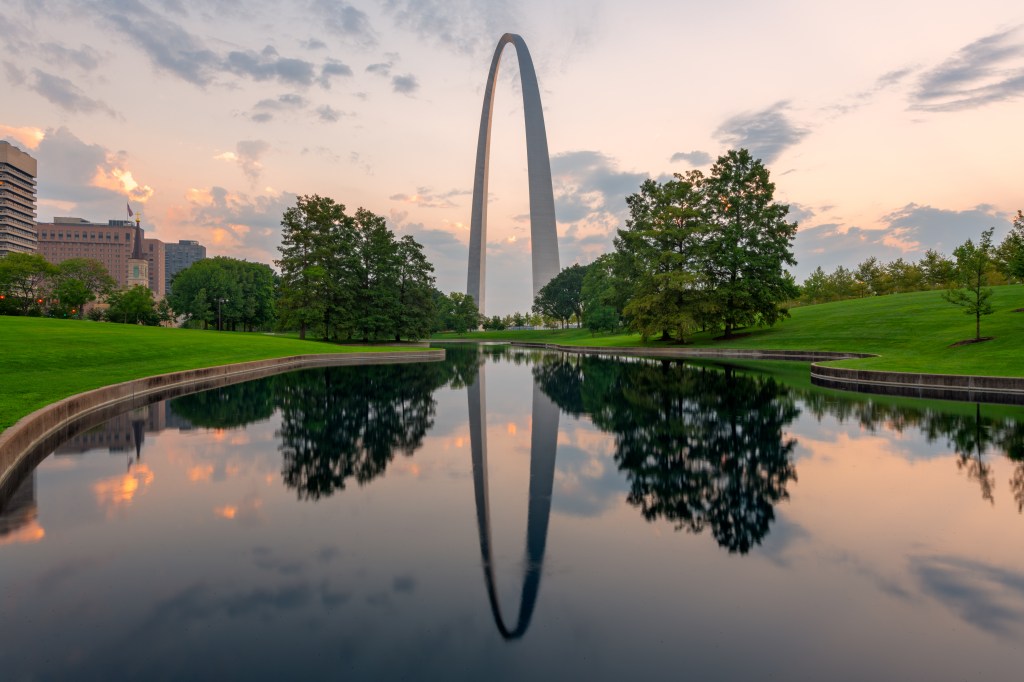
The Gateway Arch stands as a soaring symbol of Thomas Jefferson’s vision to stretch the United States toward the West — and into the land that it is today. Towering 630 feet above the grassy fields of Gateway Arch National Park in downtown St. Louis, not only is it the world’s tallest arch, but it’s also the tallest memorial in the US. It’s twice as tall as the Statue of Liberty and dwarfs the Washington Monument by 75 feet. The structure is exactly as wide as it is tall.
As for its innovative design? That’s the work of Finnish-American architect Eero Saarinen, who won the hotly contested Jefferson National Expansion Memorial Competition in 1948. The seamless curve — made of 886 tons of stainless steel — was heralded as a way to honor the rich heritage of the city’s past, paired with a nod to the future. It took nearly two decades for Saarinen’s original design to come to fruition. Sadly, he never saw the finished product. In 1961, Saarinen died of a brain tumor at the age of 51, four years before workers installed the final exterior piece of the arch’s facade.
Nowadays, a tram still takes visitors to the top of the arch, where views can expand for 30 miles. Seeking to elevate the Arch experience, the $380 million CityArchRiver project — completed in 2018 — ushered in changes including 11 new acres of park featuring 5 miles of bike and walking paths, and an outdoor natural amphitheater.
A Guide to Gateway Arch National Park
During your visit, make time to browse the Gateway Arch Museum, which opened in 2018 — and offers free admission. The exhibits cover the westward expansion of the United States and the role St. Louis played in it from 1764 to 1965, including sections on Colonial St. Louis, Jefferson’s Vision, Manifest Destiny, the Riverfront Era, New Frontiers, and the building of the Gateway Arch.
Voyageurs National Park (Minnesota)
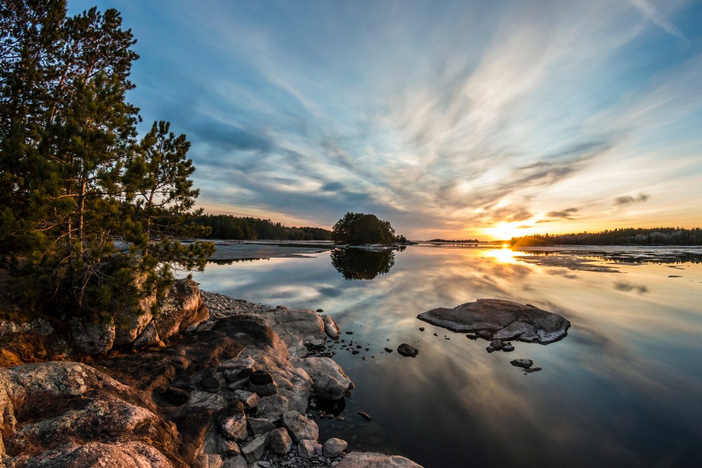
Visitors trade wheels for hulls in Voyageurs National Park — a 218,054-acre swath of the US-Canada border. Canoes, kayaks, motorboats, and houseboats ply the park’s four large lakes (Rainy, Kabetogama, Namakan, and Sand Point) and 26 smaller lakes, linked by narrow channels.
All told, the park holds fewer than 10 miles of roads and more than 80,000 acres of lakes and waterways. More than one-third of Voyageurs’ area is water. Thirteen designated visitor-destination sites illuminate the area’s colorful past, from the French- Canadian fur traders who paddled birchbark canoes through the region in the late 18th and early 19th centuries (voyageurs means “travelers” in French) to the bygone resort era of the 1930s. Modern-day voyageurs hungry for nature can behold Rainy Lake’s 80-foot granite cliffs at Anderson Bay (one of the most photographed spots in the park) or Sand Point Lake’s 125-foot bluff at Grassy Bay (one of the highest points in the park). Hikers can ramble on 27 miles of trails (the Cruiser Lake Trail, which crosses the Kabetogama Peninsula, is a favorite for moose-spotting).
Casual observers can wander through the historic Ellsworth Rock Gardens. Here, rock sculptures and terraced flower beds form a striking work of art. Curiously, some of the oldest exposed bedrock on Earth is found within this relatively young national park, established in 1975. Sanded, shaped, and scarred by at least four ice ages, the prehistoric land here tells a fascinating story. Those who pay close attention will hear it, along with the rustling of North Woods pines, the haunting cry of loons, the howling of wolves, and, of course, the gentle lapping of pure, pristine water.
A Guide to Voyageurs National Park
Find lodging, supplies, guide services, and boat rentals in Voyageurs’ gateway communities of Orr/Pelican Lake, Ash River Trail/Kettle Falls, Crane Lake, International Falls, Rainier and Rainy Lake, and Kabetogama Lake. The park offers three visitor centers, as well as ranger-led canoe programs and sightseeing cruises. There is only one lodging option within the park — the circa 1913 Kettle Falls Hotel. Some 200 tent and houseboat sites are reachable only by boat. In the winter, go wild on 110 miles of groomed snowmobiling trails.
Isle Royale National Park (Michigan)
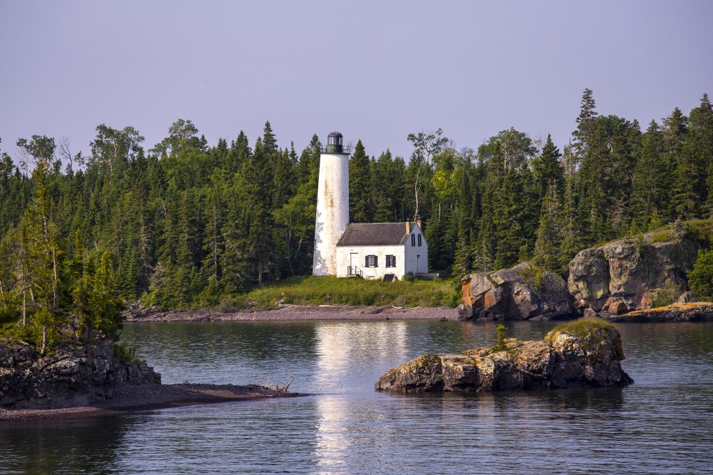
In the middle of the largest freshwater lake (by area) in the world lies an island so remote and rugged that it has no roads or cars. Travelers must arrive by boat or floatplane. This “eye” of Lake Superior is Isle Royale, a national park since 1940. Isle Royale was named an International Biosphere Reserve in 1980. The least-visited national park in the contiguous US, Isle Royale sees an average of only 18,000 people a year — and they must really want to come, as the ferry ride from park headquarters in Houghton, Michigan, takes six hours.
Once there, passengers are rewarded with solitude, serenity, and pristine North Woods scenery. Visitors to the more populous Rock Harbor area can board the Sandy to cruise past sights like the circa 1855 Rock Harbor Lighthouse. On foot, hikers head for picturesque Scoville Point via the Stoll Trail (4.3-mile loop), named after journalist Albert Stoll, who fought to preserve the island.
Sightseers bound for the Windigo area can paddle or dive into the invigorating waters of Washington Harbor. Throughout the park, trekkers explore 165 miles of trails, keeping their eyes peeled for 18 elusive mammal species. These include moose, beavers, red fox, mink, river otters, snowshoe hares and gray wolves. While visits to most national parks average only four hours, those who make the long journey to Isle Royale (open April 16–October 31) typically stay four days. It’s a testament to the permeating allure of the park’s isolation and unspoiled natural beauty.
A Guide to Isle Royale National Park
Ferry options include the NPS-operated Ranger III from Houghton, Michigan (six hours); the Isle Royale Queen IV from Copper Harbor, Michigan (3.5 hours); and Grand Portage Isle Royale Transportation Lines in Grand Portage, Minnesota (1.5 hours). Alternately, arrive courtesy of Isle Royale Seaplanes. On-island lodging includes 36 primitive campgrounds, the Rock Harbor Lodge, and the Windigo Camper Cabins.
Wind Cave National Park (South Dakota)
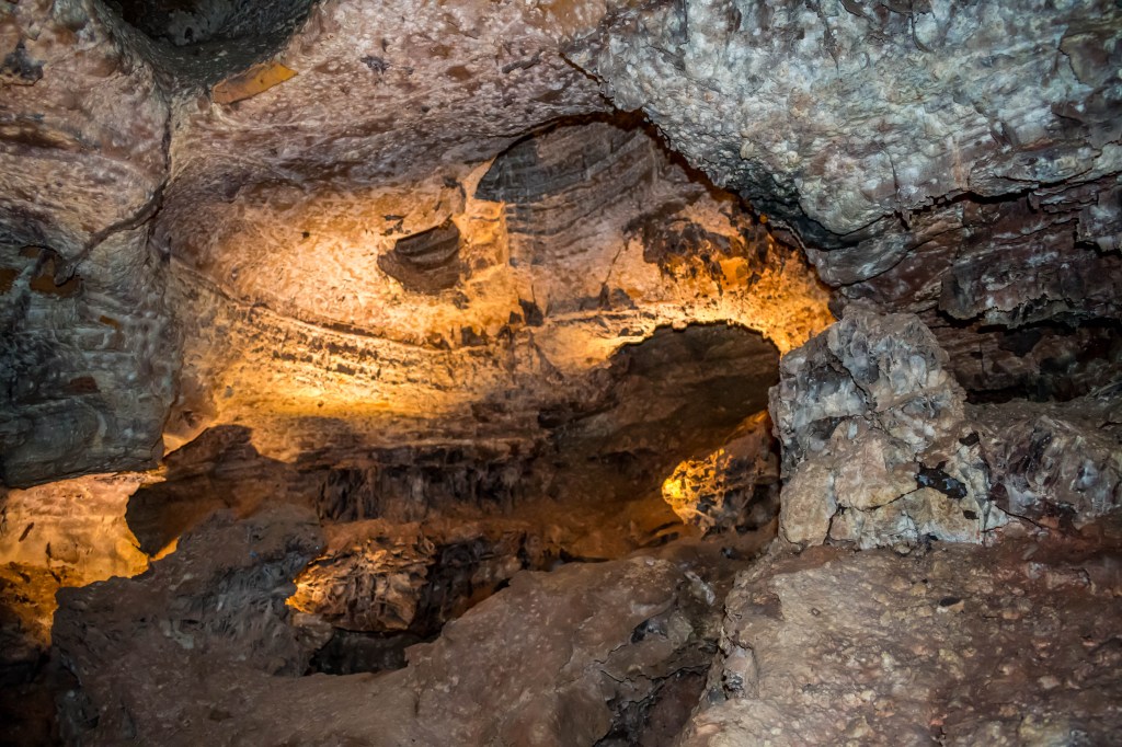
In the black hills of South Dakota lies a park with a split personality. One side is sunny, open, full of life. The other, dark, mysterious and deeply spiritual. The latter whistles to passersby, enticing them to step inside and see the wonders within. This twofold place is Wind Cave National Park, where the world’s sixth-longest cave hides beneath ponderosa pine forests and mixed-grass prairie lands teeming with wild animals. Most visitors come to explore the park’s namesake cave, whose whistling sound (produced by changes in atmospheric pressure) led to its modern discovery by two brothers in 1881. It became America’s eighth national park in 1903, but it has long been revered as sacred by the Lakota people.
Rangers host five different tours inside the cavern, ranging from 30 minutes to four hours
in length. Notably, the Fairgrounds Tour (1.5 hours) reveals the cave’s outstanding boxwork formations, the best and most extensive example of these thin calcite honeycombs on the planet.
An entirely different world waits above ground. Sixty percent of the park’s 28,295 acres is open prairie, and wildlife-spotters regularly spy bison, elk, pronghorn, and prairie dogs from park roads. Bison were reintroduced to the area in 1913 and are now thriving. Outside the car, 30 miles of trails include the hike to 5,013-foot Rankin Ridge, the highest point in the park. Here, visitors savor sweeping vistas of the Black Hills, while knowing Wind Cave’s shadowy secrets lie just under the surface.
A Guide to Wind Cave National Park
Wind Cave is a one-hour drive from Rapid City. Tickets for ranger-led cave tours must be purchased from the visitor center. Arrive early and dress warmly (the cave is 54 degrees year-round). The Elk Mountain Campground is the park’s only campground. Lodging and other amenities are available in the surrounding towns of Hot Springs and Custer.
Cuyahoga Valley National Park (Ohio)
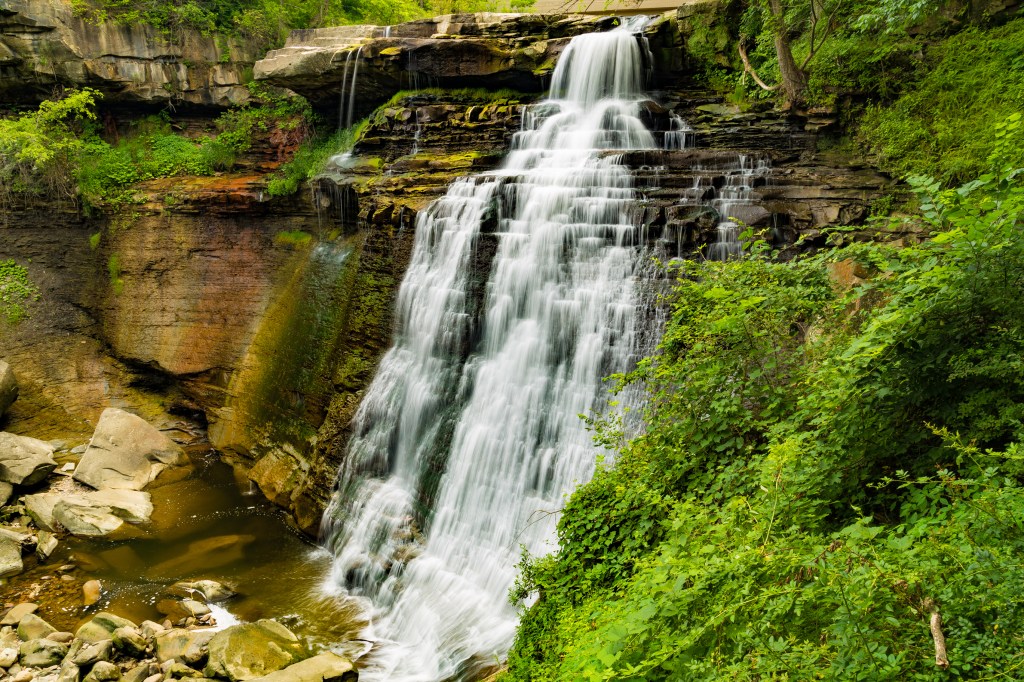
Cuyahoga Valley National Park is one of the most-visited national parks in the country — so why haven’t many people heard of it? Chances are, if you don’t know about this park, tucked in Ohio’s northeastern corner between the cities of Cleveland and Akron, it’s because you don’t live in the Buckeye State. Only 20 percent of park users hail from outside state borders. For those in the know, the park’s varied attractions are pure delight.
The centerpiece of Cuyahoga Valley is the Ohio & Erie Canal Towpath Trail, which cuts through the park for 20 miles (the full trail is 85 miles). Stops along the way include visitor centers, 11 trailheads, and the Beaver Marsh boardwalk. Nature lovers flock to the Ritchie Ledges (towering sandstone cliffs) and 65-foot Brandywine Falls. Quirkier diversions range from the Blossom Music Center and the Porthouse Theatre, to several golf courses and the Cuyahoga Valley Scenic Railroad.
The Cuyahoga River Valley was named a National Recreation Area in 1974. To further define the landscape, it became a national park in 2000. A new visitor center opened in 2019, giving curious travelers even more reason to check out this scenic local celebrity.
A Guide to Cuyahoga Valley National Park
During the winter months, Boston Mills and Brandywine ski resorts operate within the park, and the Towpath Trail remains unplowed for cross-country skiing. From late April through October, the Countryside Farmers’ Market at Howe Meadow peddles fresh foods, arts, crafts, flowers, and more every Saturday. To stay within the park, there are two options: the nine-room Stanford House and the six-room Inn at Brandywine Falls.
Theodore Roosevelt National Park (North Dakota)
While President, Teddy Roosevelt set aside more than 200 million acres of land for preservation — arguably the most any president has done for the National Park Service. And it was his time in North Dakota that sparked his passion for conservation. He first traveled to the territory that is now Theodore Roosevelt National Park to hunt and ranch cattle, and the area proved to be a salve after he lost both his wife and his mother on the same day in 1884.
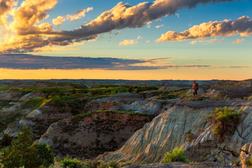
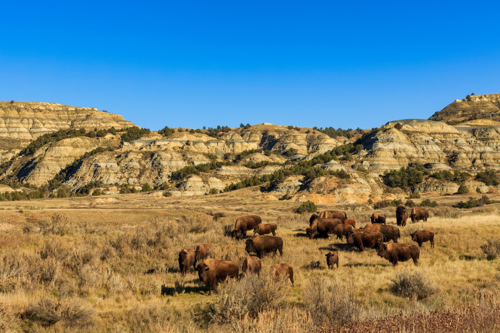
Today, visitors can still see Roosevelt’s Maltese Cross Cabin and wander the site of his Elkhorn Ranch. Designated a national park in 1978, TRNP memorializes the 26th president while protecting 70,000 acres of prairie grasses, rolling buttes and painted badlands, all along the Little Missouri River.
Most visits begin in the park’s South Unit, where the 36-mile Scenic Loop Drive winds past 12 trailheads and pull-offs, like the popular Painted Canyon Overlook. This section also boasts a petrified forest and prolific wildlife, including prairie dogs, bison, deer, pronghorn, badgers, and elk. Rugged badlands and wild horses are classic sights in this stark park. Seventy miles away, the North Unit has its own 14-mile scenic byway, with stops such as the River Bend and Oxbow overlooks. Between the two units, the 218-acre Elkhorn Ranch site sees the fewest visitors. Here, Roosevelt himself might be pleased to learn this remote riverside plot remains as pristine as it was the day he discovered it.
A Guide to Theodore Roosevelt National Park
The park operates two campgrounds within its borders — Cottonwood in the South Unit (near Medora) and Juniper in the North Unit (near Watford City). Additional lodging is available in each nearby town. Both units have a year-round visitor center, and the South Unit runs a second center during the summer. Popular activities include horseback riding and paddling down the Little Missouri River. Contact park rangers before traveling to the Elkhorn Ranch site.
A version of this article appeared in our partner magazine Complete Guide to the National Parks.


